C-MAP MAX NA-M026 - Great Lakes & The Maritimes - C-Card
NA-M026 => Great Lakes, Northeast Coast and Approaches
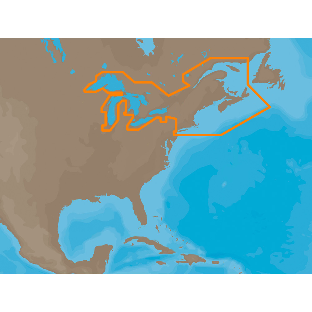
Coverage of the Great Lakes, St. Lawrence River and Northeast United States. Coverage of the Great Lakes also includes Fox River and Lake Winnebago, Lake St. Clair, Rideau Canal, Ottawa River and the Trent-Severn Waterway. Includes all coastal charts for New Brunswick and Nova Scotia in Canada and Maine, New Hampshire, Massachusetts, Connecticut and New York in the U.S. Also included is coverage of the Hudson River and Lake Champlain as well as the Erie Barge Canal.
This product may not be returned to the original point of purchase. Please contact the manufacturer directly with any issues or concerns.
Export Data Easily
CWR understands how important data export is to allowing your business to thrive. From order history to shipment data files to product files and beyond, we provide a variety of ways to view and analyze data on your end.
Top Selling C-MAP Products
Over 300 Brands at Your Fingertips
We have great relationships with some of the most respected and reliable brands in the business and we are here to pass on the benefits of those relationships to you, the client. With CWR, you can be assured that our customer service team is providing the best, most accurate, and most up-to-date information about your products.
Become a CWR dealer and get:
- Wholesale pricing from over 300 brands
- No minimum order
- Flat rate shipping as low as $9.95
- Free FTP and website integration
BECOME A DEALER