Furuno Great Lakes & Maritimes Vector Charts - 3D Data & Standard Resolution Satellite Photos - Unlock Code
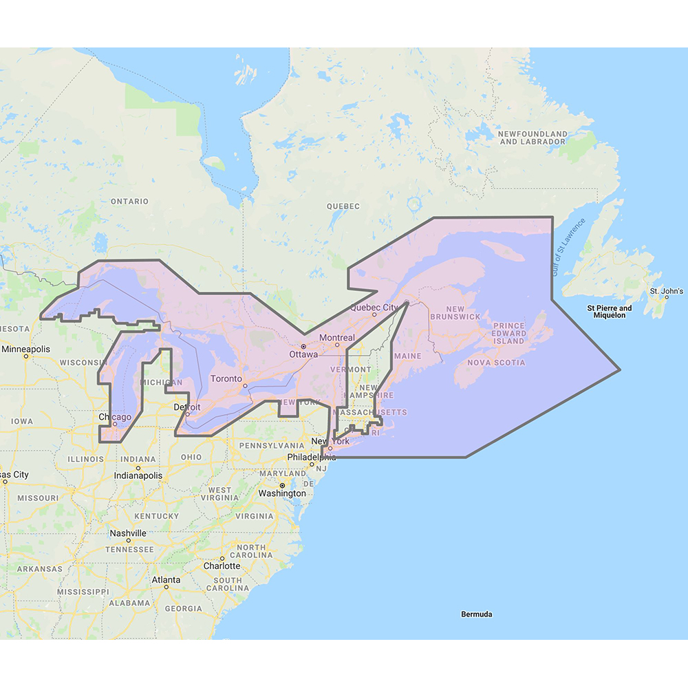
Great Lakes & Maritimes Vector Charts - 3D Data & Standard Resolution Satellite Photos - Unlock Code
**SYSTEM ID NUMBER IS REQUIRED TO RECEIVE AN UNLOCK CODE**
C-Map Wide Chart - Great Lakes and Maritimes. Vector charts, 3D data & standard resolution satellite photos.
This Chart Pack includes vector charts, 3D data and standard resolution satellite photography for Great Lakes and Maritimes. C-Map chart data is used and converted to the TimeZero format. These C-MAP charts are comprised of the same cartographic chart information found in C-MAP MAX and C-MAP MAX PRO charts.
To purchase this chart pack for NavNet 3D, TZT or TZT2, you will need to provide your NavNet system ID to your local authorized Furuno dealer. The system ID can be located under the “My NavNet” menu.
 WARNING: This product can expose you to chemicals which are known to the State of California to cause cancer, birth defects or other reproductive harm. For more information go to P65Warnings.ca.gov.
Same Day Shipping
Place your order before 4pm and it will ship the same day! Not many wholesalers can offer this kind of speedy delivery at such an affordable price. But at CWR we do not believe you should have to choose between speed and affordability.
Top Selling Furuno Products
CWR's Facilities
With two large facilities and a partnership with over 300 brands in the marine and outdoor industries, CWR’s selection and service cannot be beat. We have an inventory with over 18,000 unique products in stock, ready to ship, and at a competitive wholesale price.
Become a CWR dealer and get:
- Wholesale pricing from over 300 brands
- No minimum order
- Flat rate shipping as low as $9.95
- Free FTP and website integration
BECOME A DEALER