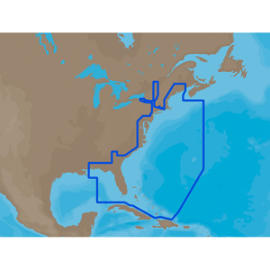
C-MAP M-NA-Y214-MS US Lakes South East REVEAL™ Inland Chart
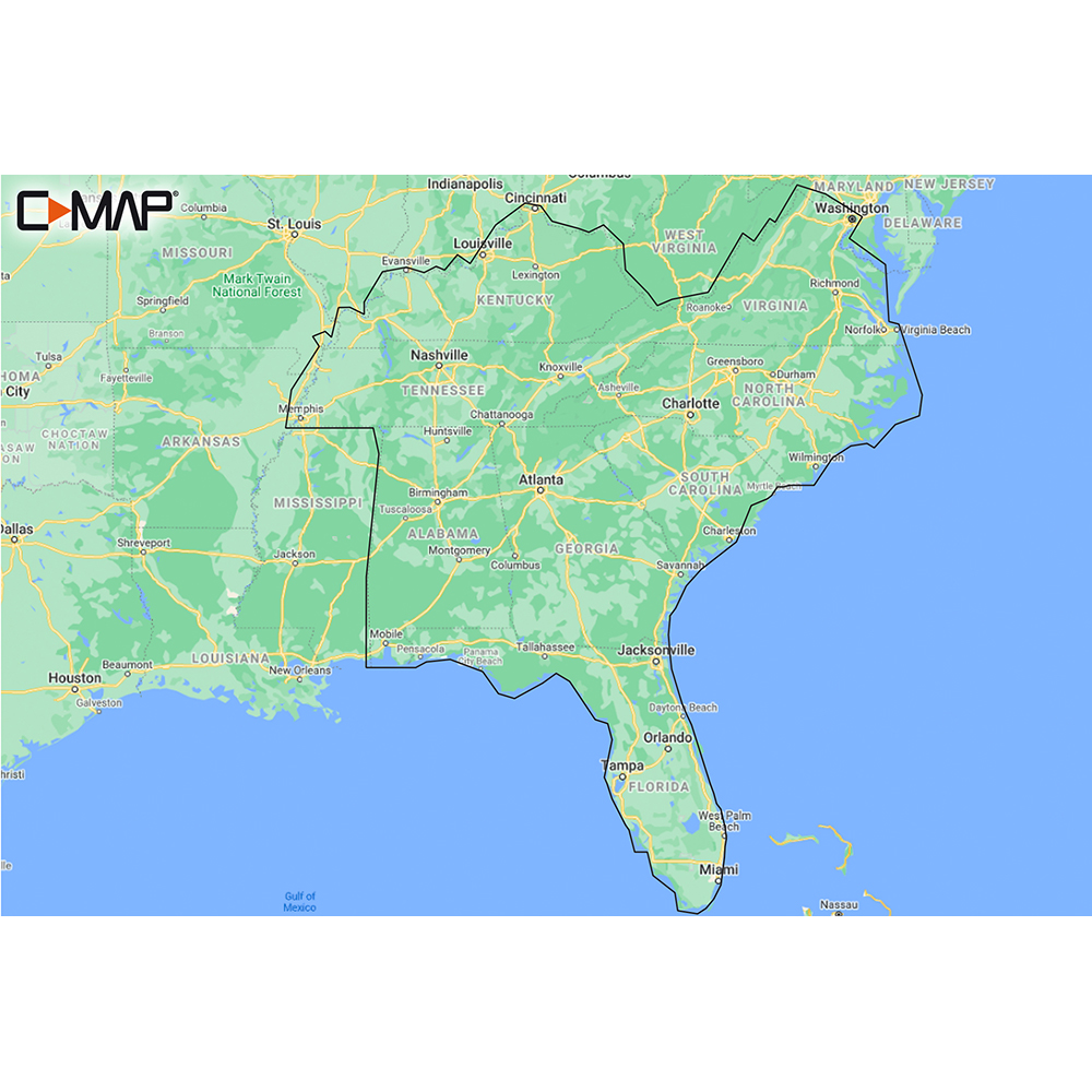
M-NA-Y214-MS US Lakes South East REVEAL™ Inland Chart
Whether cruising or fishing or C-MAP® REVEAL™ Lakes charts offer the very best of C-MAP. With Shaded Relief, including Reveal Seafloor, Aerial Photography and Satellite Overlay presentation added to the core C-MAP features found in DISCOVER™ – full-featured Vector Charts, with Custom Depth Shading, Tides & Currents and Easy Routing. It also includes the very best of C-MAP High-Resolution Bathymetry, including integrated Genesis® data.
*Purchase includes a full 12 months of online updates.
**Compatible with Lowrance, Simrad & B & G Chartplotters.
Features:
- Shaded Relief – bring the world around you to life, with 3D rendered land and underwater elevation – a game-changer for anglers.
- Aerial Photography – a collection of thousands of photos of marinas, harbors, inlets and other notable navigational features included to offer an additional level of detail.
- Satellite Overlay – satellite imagery gives information about the surroundings when you find yourself in an unfamiliar place.
- Full-Featured Vector Charts – making navigation easy by giving you accurate, up-to-date vector chart detail derive from official Hydrographic Office information.
- Custom Depth Shading – set a clear safety depth, maintain a paper-like view or create your own custom shading.
- High-Resolution Bathymetry – HRB layer helps you identify shallow areas, drop-offs, ledges, holes or humps. Now includes compiled and quality-controlled Genesis detail as part of singular HRB layer.
- Easy Routing – helps you automatically plot the shortest, safest route based on detailed chart data and your personalized vessel information.
- Tides & Currents – shows projections of water level and direction of tides to help plan your day out, cruising, angling or sailing.
- Detailed Marina Port Plans – docking in an unfamiliar port is no problem when you have precise layouts of thousands of marinas, including slip spaces, restricted areas and other valuable navigation information.
- Harbor & Approach Details – unprecedented level of detail. Approach any harbor and inlet with confidence. The perfect conclusion to a long voyage, sailing adventure or an exciting day of fishing.
- Online Updates – keep your chart up to date, with 12 months’ free online updates.
Get Access To Our Dealer Website
Featuring wholesale pricing on products from over 300 manufacturers, your CWR dealer account will also give you access to product automation software. Automatically add, update, and maintain products on your website. The best part? It’s free!
Top Selling C-MAP Products
Easy and Convenient Drop-Shipping
CWR’s drop-shipping system has been crafted to meet your business needs. We understand that maintaining a competitive business means having access to shipping that is quick, convenient and affordable. Even at a moment’s notice, we are ready.
Become a CWR dealer and get:
- Wholesale pricing from over 300 brands
- No minimum order
- Flat rate shipping as low as $9.95
- Free FTP and website integration
BECOME A DEALER